

Universe, Moon and the Earth
Universe, Moon and the Earth
Section titled “Universe, Moon and the Earth”2020-04-28 23:21:11
- Universe, Moon and the Earth
Moon and the Universe
Section titled “Moon and the Universe”Origin of Earth - Theories
Section titled “Origin of Earth - Theories”- Nebular hypothesis : by Immanuel Kant revised by Laplace : planets were formed out of a cloud
- Binary theory : by Chamberlain and Moulton : wandering star came near formation of cigar shaped extension separated and condensed to form planets
Modern Theories
Section titled “Modern Theories”- Big Bang Theory was first proposed by Georges Lemaitre in 1931.
- All matter in one tiny ball
- exploded 13.7 bil years ago -> first atoms.
- Temp dropped - atomic matter
- universe became transparent.
- Hoyles’s concept of steady state : Universe roughly the same at any point in time
Formation of Stars and Planets
Section titled “Formation of Stars and Planets”- Stars are formed by localised clumps in a Nebula
- Stages in the development of planets are :
- core of a nebula becomes surrounded by a rotating disc of gas and dust due to gravitational force
- cloud condenses -> round objects planetisimals
- Which come together to form planets
- 1st 4 planets are Terrestrial and others called Jovian/Gas Giant
| Jovian | Terrestrial |
|---|---|
| Core is denser | Core not dense |
| Spin more and are flattened at the poles | Spin less hence poles are less flattened |
| more moons | less |
| Have mostly H2 and He in atmosphere | Have CO2 and N2 |
- Dumb bell theory by George Darwin - Earth expelled a piece of its mass
- large body collided into Earth and formed the Moon was the Big Splat Theory
- Moon Craters created by 2 processes : volcanism and cratering.
- largest - South-Pole Aitkin basin.
- lack water, atmosphere and techtonic plates reason for little erosion.
[[kegy202.pdf]] - Origin and Evolution of the Earth NCERT
Evolution of Earth
Section titled “Evolution of Earth”- Formation of lithosphere : heavier materials sank towards the centre, lighter ones came up cooled and formed crust
Atmosphere
Section titled “Atmosphere”Stages in evolution of present atmosphere are :
- Initially made of Hydrogen and Helium/primordian atmosphere lost due to solar winds
- Hot interior released gases and water vapour called Degassing
- Leading to the formation of an early atmosphere containing water vapour, N2, NH3, CO2, CH4, contained little free oxygen.
- Life conc in oceans; photosynthesis saturated oceans w/ O2 which then flooded out
- Atmosphere is composed of Gases, Water vapour and Dust particles
- Water Vapour
- in warm tropics account for 4% of air by volume, less than 1 in poles and deserts
- absorbs part of insolation, prevents E from becoming too hot or cold
- Dust
- conc in lower layers, air currents can take them higher
- subtropical and temperate regions have higher conc due to dry winds blowing
- act as Hygroscopic nuclei
- Water Vapour
Structure
Section titled “Structure”- Troposphere
- Avg height 13km, 8 near poles 18 near equator; temp dec as we go higher
- contains dust, water vapour; all climatic/weather changes takes place here
- Air temp at Tropopause is -80C
- Stratosphere
- Extends upto 50km; Contains the Ozone layer
- Mesosphere
- Extends upto 80km; Temp dec w/ inc in height reaching 100 C
- Ionosphere
- from 80 - 400km; contains charged ions that reflect Radio waves
- Temp inc w/ height
Interior of the Earth
Section titled “Interior of the Earth”- Exogenic : from outside and Endogenic : from inside the Earth shaped the landscape of the Earth.
Sources of Information
Section titled “Sources of Information”Direct Sources of information of the Earth are
- Surface rocks
- Rocks from Gold mines
- From Deep Ocean drilling projects.
- Volcanic Eruption
Indirect sources of information about the interior of the Earth are
- Depth of the Earth - leads to inc in Temp, Pressure
- Meteorites - similar material
- Seismic Waves
- Gravity - diff gravity at places, most at Poles least over Equator
- Magnetic Field - distribution of magnetic material
Earthquakes
Section titled “Earthquakes”- point where the energy of a quake is released is called a Focus or a Hypocenter on the surface it is called epicentre.
- Hypocenter/ Focus is point of release of Energy
- Point on the surface nearest to Focus is Epicentre
- All earthquakes take place in Lithosphere
- Intensity measured through Mercalli scale(0 -12), Magnitude by Richter. Mercalli takes into account visible damage by the event.
- foci in areas of mid oceanic ridge are at shallow depths and in Alpine Himalayan belt are deep seated
1. Body Waves
Section titled “1. Body Waves”- generated due to release of energy at focus.
- move in all direction
- further divided into- P and S waves.
- Primary Pwaves
- faster and first to arrive at surface
- Move through Solid, Liquid and Gas and are similar to sound waves
- vibrate parallel to direction of the wave -> stretching and squeezing of material
- shadow zone b/w 105deg - 145deg
- Secondary S-waves
- through only Solids; more destructive
- last to record on seismograph
- travel perpendicular to waves and cause crest and troughs
- shadow zone lies beyond 105deg
2. Surface Waves
Section titled “2. Surface Waves”- formed when Body waves interact with surface rocks
- velocity and direction changes depending on the material density
The Various types of Earthquakes are :
- Tectonic Earthquakes
- Volcanic Earthquakes : special class of techtonic earthquakes.
- Collapse Earthquakes : intense mining leads to roofs collapsing
- Explosion : of chemical or nuclear weapons.
- Reservoir Induced
Structure of the Earth
Section titled “Structure of the Earth”Crust
- Oceanic crust (5km) thinner than continental (30km) crust
- oceanic crust rock is Basalt
- brittle, thicker under Mountains
- density from 2.7-3 gm/cm3
Mantle
- Extends from Mohos discontinuity to 2900 km has density of 3.4gm/cm3
- Upper portion is asthenosphere (astheno=weak) upto 400km contains most of the Magma
- Crust and upper mantle is called Lithosphere 100-200km
Core
- Extends from 2900km to 6300km
- Outer core is Liquid and inner core in solid state
- Density varies from 5 - 13 g/cm3
- Mostly consists of Nickle and Iron aka Nife layer
Volcanoes
Section titled “Volcanoes”Shield Volcanoes
- largest of all eg Hawaiian.
- mostly made up of Basalt very fluid.
- generally low exlosive until water gents into the vent.
Composite Volcanoes
- Eruptions are cooler and more viscous than basalt
- Along with lava pyroclastic material and ashes are given out accumulates in the vent openings making the mouth appear as composite volcano.
Caldera
- most explosive, often collapse on themselves forming depressions called caldera
- magma source is closer and bigger than others
Flood Basalt Provinces
- Very fluid lava travels long distances it is also thick more than 50m
- Eg the deccan traps.
Mid Ocean ridge volcanoes
- stretches more than 70,000km
- central portion experiences frequent eruptions
Volcanic Landforms
Section titled “Volcanic Landforms”- Depending on the cooling of the lava, igneous rocks are classified as volcanic rocks and plutonic rocks
- Rocks that cool in the crustal portion takes different forms called the Intrusive forms
- Dome shaped, granite bodies of cooled magma chamber formed in deeper depths of crust and appear on the surface after erosion are called Batholiths
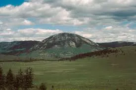
- Large dome shaped intrusive bodies connected by pipe like conduits from below, localised sources of lava are called Laccolith. Eg Domal hills of granite rocks in Karnataka.
- Horizontal flow of lava forms a saucer shape concave to the sky body Found at base of synclines and top of anticlines are called Lopoliths.
- Phacoliths are are conduits that source lapoliths from magma chambers
- Thin and Thick horizontal bodies of intrusive igneous rocks are called sheets and sills
- When lava solidifies perpendicular to the ground and cools at the same position to develop a wall like structure are called Dykes. Found in Maharashtra they were feeders for the eruptions that formed Deccan traps.
Distribution of Oceans and Continents
Section titled “Distribution of Oceans and Continents”Continental Drift
Section titled “Continental Drift”- Alfred Wegner in 1912 put forward continental drift theory.
- single continental mass Pangea (split into 2 Laurasia and Gondwanaland) and mega ocean called Panthalassa
Evidence in support of continental drift
- Jig saw fit of continents
- Rocks of same age across oceans suggesting no ocean existed b/w them
- Tillite : sedimentary rock formed out of deposit glaciers found in India are also found in all six diff landmasses in the southern hemisphere
- Placer deposits of gold in Ghana but source rock is missing
- Distribution of Fossil
- According to Wegner Polar fleeing force ie rotation of the Earth and Tidal force i.e. attraction of moon and sun were responsible, found to be untrue.
Post Drift Studies
Section titled “Post Drift Studies”- Arthur Holmes put forward the Convectional Current Theory it said radioactive elements cause thermal difference leading to the formation of currents in the mantle.
- Mobile rock beneath plates move in a circular manner, heated material comes up cools and goes back down again. Process repeats endlessly forming a current.
- Radioactive decay and Residual heat are reasons source
- Rocks equidistant from the Mid Oceanic Ridge volcanoes had similar properties
- [[Oceans and Coastal Landforms]]
Plate Techtonics
Section titled “Plate Techtonics”- Plate tectonics theory was put forward by Mckenzie and Parker in 1967
- Tectonic plates are Massive irregularly shaped slab of solid rock composed of continental and oceanic lithosphere.
- 7 major and other minor plates
- What are the types of plate boundaries :
- Divergent Boundaries eg Mid Atlantic Ridge, generates new crust
- Convergent Boundaries : forms the subduction zone where one plate dived into another
- Transform Boundaries : plates slide horizontally past each other, crust neither produced nor destroyed
- Indian Plate aka Indo Australian
- Continent convergence along Himalayas forming a subduction zone
- Tethys sea separated Eurasian plate(part of Laurasia) and Indian Plate (part of Gondwana)
- During movt lave outpoured forming the Deccan traps
Diastrophic Plateaus :
| Name of Plateaus | Properties |
|---|---|
| Intermontane Plateaus | highest and largest show variety of topographic features Eg Tibettan Plateau |
| Mountain Border Plateaus | Piedmont plateau b.w Atalntic coast and Appalachian mountain is an example |
| Domed Plateaus | Plateau of Ozark in USA is an example |
| Volcanic Plateaus | --- |
| Erosional | found particularly in semi-arid regions and have cut away portions of high lands |
[[kegy203.pdf]] - Interior of the Earth [[kegy215.pdf]] - Life of the Earth